|
1 Comment
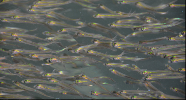
Out of tens of thousands, not one of these fingerlings (below) could escape the voraciousness of a dozen mackerel. Within minutes of taking this picture these little fellas were no more. Chula Vista Marina
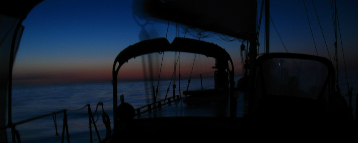
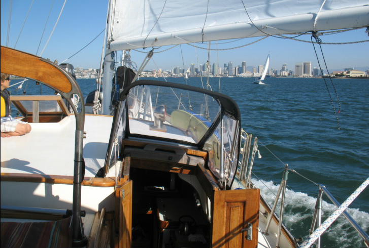
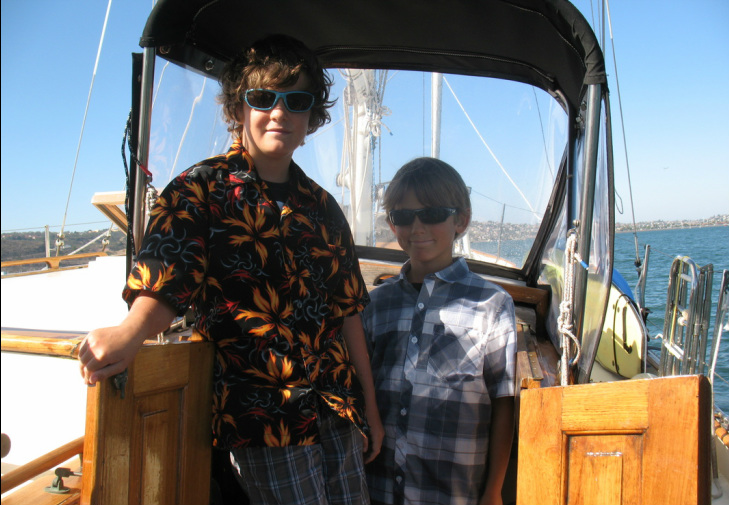
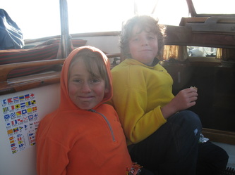
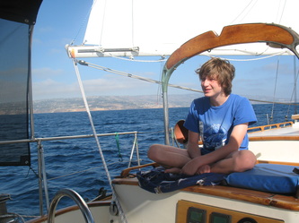
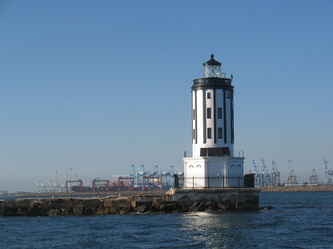
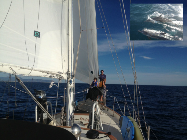
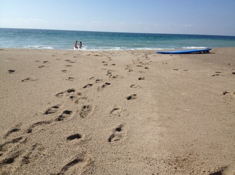
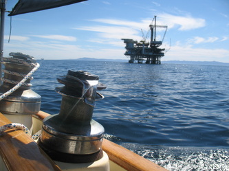
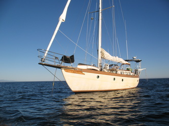
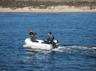
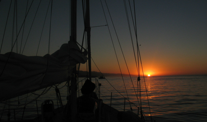
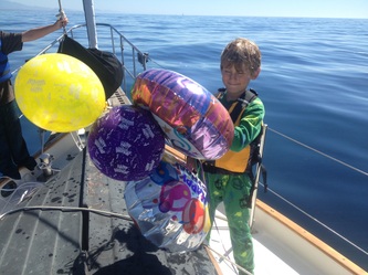
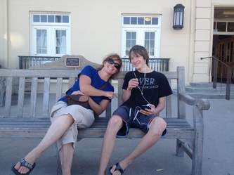
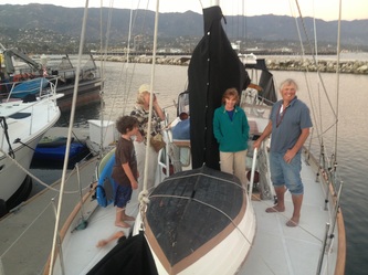
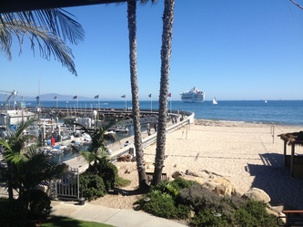
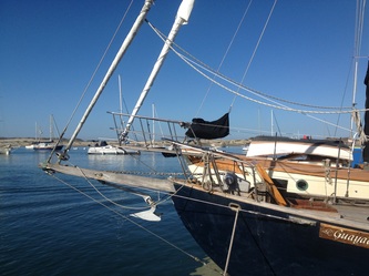
After evaluating the hazards and arrival times for the trip from Long Beach to San Diego Bay Erika and I agreed that an early departure would be imperative. The decision to set off at 12:30 a.m. wasn't our first choice but if all went according to plan we would be safely navigating the last of a very narrow channel near Chula Vista Marina by late afternoon. Erika and Mason gladly volunteered for the first watch. By 1:30 in the morning Steadfast settled into her motor-sailing groove and I into my warm and cozy bunk, leaving the "dim" witted duo at the helm. And by 3:30 a.m. I was back on deck sending my mariners to their mattresses. Through the ages sailors have venerated the coming of dawn. So, with a fresh collection of music filling my head, I weighed the last hours of darkness, all alone, sailing easterly into the coming sunrise (pictured above). 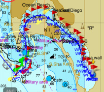 After navigating around Point Loma's extensive kelp hazards, Steadfast turned north towards San Diego Bay. By 2:30, the 18th of October, we were sharing the bay with a crowd of San Diegan sailors enjoying a sunny and breezy Friday afternoon. But we weren't done yet! It would be another two hours and twelve nautical miles before we would reach our destination, Chula Vista Marina. (Right) The blue dot located at the south-eastern side of San Diego Bay indicates our final position. Here we met up with our cruising friends aboard "Dawn Treader." In anticipation, and celebration, of seeing "old friends", especially Sophia, Loren and Elliot dressed up for the occasion (Below). 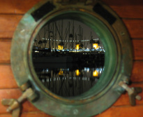 I always hope to learn a bit of cultural or scientific dirt during our brief sojourns landward. And Long Beach did not disappoint. Less than 3000 feet from our marina was the Aquarium of the Pacific. Lets just say our new, annual membership to the aquarium was well used during the six days we were docked in LB. After tearing me away from the aquarium, Ren and Elliot insisted we tour the cruise ship I've been looking at out of my porthole for the past week (Left: My porthole and the RMS Queen Mary, aka the "Grey Ghost"). All week the kids got a kick out of the timely, and loud, blast of Queen Mary's horn every morning, afternoon and evening. 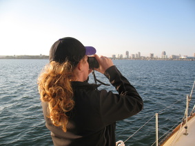 The First-Mate Spies the Port Entrance The First-Mate Spies the Port Entrance Saturday, October 12th marked the end of Steadfast's week-long stay at Anacapa Isle Marina in Oxnard and the beginning of another adventure down the California coast. We cast off at 7:05 a.m., a reasonable hour considering our next stop was roughly 66 nautical miles away. Travelling at a rate of 6.5 knots we would make the Port of Long Beach in 10 hours. Plotting a course parallel to the shipping lane was the most direct route to the busiest port in the U.S...who would've guessed! After a day of container ship spotting, reading, eating and sight-seeing we pulled into Shoreline Marina by 5pm, just in time to check-in and get a gate key from the harbor office.  Oxnard/Channel Islands Harbor Sunset Oxnard/Channel Islands Harbor Sunset Steadfast's next stop was to be a sort of homecoming. It was at the marina pictured above, over three years ago, that I found and purchased Steadfast. Approx. a week later, my brother-in-law Todd and I sailed her up to Morro Bay in exactly twenty hours, almost to the second. From there I attempted to single-hand her to Santa Cruz. Unfortunately, off the coast of Big Sur Steadfast's transmission failed. After the breakdown sailing into the wind was slow, to say the least, and after 40 hours without a wink of sleep I hailed Vessel Assist for a hand the rest of the way. I happily digress. Back to the here and now. 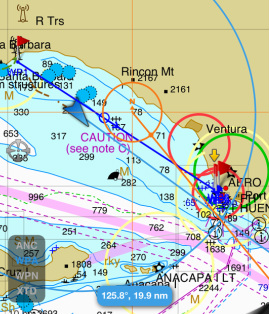 Slipping from Santa Barbara on Sunday, Oct. 6th at 1130 a.m. was a leisurely time. Casting off the dock lines in the middle of the night has its advantages but sleep isn't one of them. So it was a nice departure from our normal departure. With a sufficient slumber the night before and only 28 nautical miles to our next port-o-call spirits were steep aboard Steadfast. A 1/2 mile into our trip we were met by a lone dolphin who performed a single porpoise off our bow. It's message was construed as a sendoff but was more likely an introduction to what was to come. For over the course of the next few hours we were greeted with 100's of pacific Common dolphins, dozens of Risso dolphins and a group of breaching Humpback whales. A light to moderate nor' westerly followed us out of Santa Barbara allowing us to sail past the numerous oil platforms that dotted the coastal waters nearby, represented by the small blue circles on the chart to the left. Within a couple of hours the winds dwindled necessitating the motor to bolster our plan to be in Oxnard before sunset. And from the looks of the picture above, we made it. Top picture taken moments after tying up the boat. 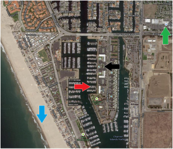 Located at the southern end of Santa Barbara Channel, the Channel Islands Harbor began as a wetland/estuary and dredged out in the 1960's to create (not unlike Santa Cruz Harbor) a man-made marina. About a mile southeast is the Navy controlled commercial deep water port of Hueneme (wy-nee-mee). The Channel Islands Harbor boasts over 2500 berths verses Santa Cruz's 1000 "coveted" spots. Oxnard's surplus of berthing wasn't brimming with boats. Our particular dock, Anacapa Isle Marina, had numerous vacancies - likely a by-product of the economy. The red arrow on the picture to the right indicates Steadfast's slip location for the week. The black arrow pinpoints the well-kept clubhouse and heated pool/spa. We put on some walking miles while grocery shopping, filling medications, ordering smoothies at Jamba Juice or buying a few boat parts at the local West Marine marked by the green arrow to the right. The blue arrow shows the spot where Elliot, Ren and I enjoyed a barren stretch of beach during the "off-season" 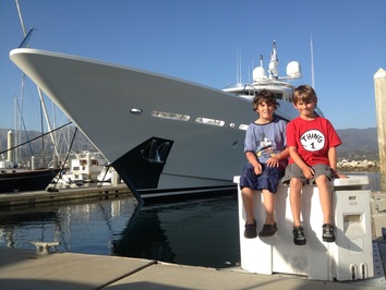 From the initial greeting to the last goodbye, Santa Barbara proved to be a positively pleasant pit-stop. Whilst leaving Coho anchorage last Sunday we really didn't have a definitive reservation for refuge. The hoard of harbors in southern Cal is really the antipodean of central Cali and its long stretches of treacherously empty coast line. So, as we were sailing south, deeper into California's bight, our chance to seek sanctuary was aplenty. Among them... Santa Barbara. Now, if you take a look at the picture to the left (Elliot, Ren and 35 Million), words like "exclusive" might come to mind. The thought occurred to us but by late morning we hailed Santa Barbara on the marine radio anyway. The harbor politely asked us to call back at 1:30 pm since that was the "late" check-out time for guest berthing. Erika called back by 1:30 and five minutes later we were booking a coveted slip in the "American Riviera" marina. 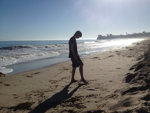 Mason is feeling very angst regarding our nomadic lifestyle. He is only looking forward to more time in one marina and therefore isn't getting off Steadfast much. Pictured right: Mason "relaxes" for a few minutes on the beach in front of the Santa Barbara Yacht Club/ Leadbetter Beach. Dad, on the other hand, is feeling angst about not "getting out" and seeing enough of the sights. Kind of a conflict of interests at the moment wouldn't ya say? The last day in Santa Barbara I enjoyed a stroll down State Street, downtown Santa Barbara, with everyone. Though not closed off to car traffic, State St. is a shopping/eating destination for tourists, "trendy" locals, and university students alike. Not quite Mason's scene. Personally, I could have stood more time hunting down museums and historical sites. 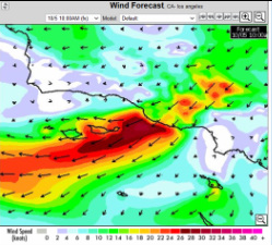 As Steadfast slumbered in Santa Barbara a large mass of cold air began building amid the high elevations of Nevada's Great Basin. With a low pressure system located in southern California, the mass of air to the north was predicted to hurry our way by the end of the week. These winds, known as the Santa Ana's, were going to rush through Southern Cal's canyons and out to sea Thursday and not abate until Saturday afternoon. If you look at the picture to the left, Santa Barbara is located right above the strong winds indicated by the red color. Ventura/Oxnard, our next destination, is located right in the middle of that red mass. We planned to leave Santa Barbara Saturday morning but decided to put off until Sunday morning. The staff in the Santa Barbara harbor office didn't flinch an inch when we requested an additional days stay...kudos for their professional hospitality. Along with the marina's moderate slip fees (0.90/ft), convenient bathrooms and laundry facilities, West Marine, convenience store, restaurants and a maritime museum just outside the gate, we would no doubt, look forward to another visit. Hasta la próxima vez! 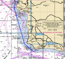 Wrapping up a pleasant stay at Morro Bay, we cast off our dock lines from the yacht club just before day break, Saturday the 28th. Expecting light conditions (NW winds 5-15 knots, seas 1-3 feet) we topped off our fuel tank the previous evening. Luckily, Erika had called the Harbor Patrol for the fuel dock's operating hours. They thought the attendant would be there till 5pm, wowzers, it was already 4 o'clock. Twelve hours later, Morro Rock astern, running lights aglow, we motored south bound for Coho, a well protected anchorage right around the corner from California's historic Point Conception. Point Conception and its brother to the north, Point Arguello, are infamous for their marine weather, turning away both historical and contemporary skippers alike. Again, our marine forecast from NOAA predicted light to moderate conditions but we really only saw the former. Pulling into the empty anchorage by 3:30 in the afternoon was a real treat. We had plenty of time to launch the dinghy, do a little surfing, and comb the beach. Returning to Steadfast a couple hours later, the troops were tired and hungry. Erika whipped up some fresh veggie and noodle stir fry and promptly fell into her bunk. I washed the dishes, rinsed the wetsuits and the boys who wore them, checked the anchor and followed Erika. Above - Rise and shine, departure time (Coho Anchorage 7 a.m.) With winds light from the SW, Steadfast motor-sailed most of the way to Santa Barbara. The little guys (Ren and E) spent the majority of our six hour sail sitting on the bowsprit watching for dolphins, and their patience payed off numerous times. Mason, on the other hand, slept till noon. I personally kicked him out of his bunk to, at least, witness our arrival into Santa Barbara Bay. Below - 13 second HD Video of Dolphins bow riding Steadfast while Ren and Elliot watch from the bowsprit above. 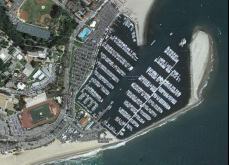 Travelling down the coast on a Sunday probably increased our chances of running into more "birthday" balloon bouquets than on your average weekday. We yanked the ones we saw along our path...pictured below, according to the design on this "rescued" bouquet, someone turned 60, but it wasn't Loren. Sailing into SB this weekend was like sailing into Disney-marina! Aside from the Cruise ship parked outside the marina with their numerous bright yellow shuttle boats taxing back and fourth, or the 50 junior sailors clogging up the north side of the harbor, obviously in the middle of a mini-regatta, or the screaming-cheering from the Pro Volley Ball tournament (Kerri-Walsh, etc) just up the beach from the harbor entrance, or "Harmony", a 164 foot mega Yacht a few slips from our humble 50 foot end-tie.... you might be getting the picture, Erika and I looked at each other....Welcome to Southern California! Luckily, as warned by our numerous neighbors, Monday proved much quieter. By morning, everyone was back to work, including us. For dinner, we were treated with a special visit from Aunt Sonja and Uncle Shorty. After feasting at a pleasant eatery near the marina, we walked back to the boat and showed off Steadfast. Later that evening, according to Erika, I was suppose to check for stowaways...but I really couldn't see how Uncle Shorty could hide in any of our stowage compartments... ;) 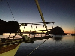 It is getting close to another departure day. The seas are finally taking a rest from the gale force winds that have dominated over the last couple days. Four cruising boats, us included, hope to head south Saturday and two will be headed north - back home. Yesterday the gale winds filled the bay, pushing and pulling Steadfast from the MB Yacht club dock. By early afternoon the strong winds were not ceasing so we added a few more fenders and dock lines to ease the on going stress the wind and chop was causing. On a slightly freaky side, our neighbor saw a 40 foot power boat blowing down the channel after it broke from its mooring ball. Luckily she ALSO saw the Harbor Patrol boat close on its heels and no harm was done. The picture above is what evenings here usually look like to the west.... a silhouette of sailboats, sand dunes and Morro Rock, which stands 581 feet. Warning, warning - Geology/Spanish lesson ... A morro is a rocky outcrop in the shallow waters of a harbor, often round in shape and sometimes very high. They are commonly made of hard granite or quartz. The word is taken from the Spanish word morro, which has several meanings, including a rounded headland or bluff. A couple other famous morros include Moro Rock (245 ft) in Sequoia National Park and Sugarloaf Mt. (1299 ft) in Rio de Janeiro. O.K., lesson over! Whew! Above Picture - The little guys and I saw this congregation of Pelicans on an old barge while toodling down the bay in the dinghy this morning. 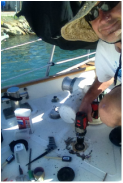 Steadfast's windlass deck foot-switch has been on the "blink" over the last few weeks...aka stopped working due to the entire switch corroding into one solid piece of rust. Today I finally pulled the switch out of the deck, cut, cleaned and epoxied the hole, finally bedding the new switch in with SS screws and 5200 adhesive sealant. Now, I hope, pulling up the anchor won't require my aching back anymore...just my big toe! Thanks Keiley for bringing down your dad's power drill. That was one less thing I had to buy and hike back from the hardware store across town. Boy, between the grocery store and the hardware store, I think I racked up 15 miles running, literally, around this week. After enjoying the morning exploring the beaches and caves around San Simeon Bay, we weighed anchor about 1:30 pm and set off for our next destination.... 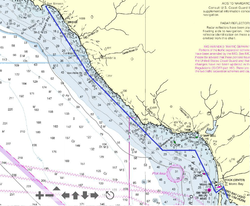 We've sailed "26 miles across the sea" a few times, but it wasn't to Catalina this turn. The distance from San Simeon to Morro Bay works out to be about 26 nautical miles which translated to about a four hour sail. The Nor'westerlies resumed and we gybed down the coast passing Cambria and Cayucos along the way. The forecast along our route called for 15 - 20 knots so Erika and I tucked a reef in our new mainsail and rolled out our new headsail on our new Schaffer 3100 furling system....yeah baby! Presently Steadfast is resting along the Morro Bay Yacht Club dock for the week. Check it out live at http://www.mbyc.net/webcam1/ with their cool webcam, updated every 60 seconds. |
AuthorA UCSC graduate in Marine Biology, Keith holds a 100 ton USCG Capt. License and is an ASA/US sailing certified instructor. Archives
March 2022
Categories |



 RSS Feed